|
| *****SWAAG_ID***** | 618 |
| Date Entered | 08/10/2012 |
| Updated on | 08/10/2012 |
| Recorded by | Tim Laurie |
| Category | Geological Record |
| Record Type | Geomorphology |
| Site Access | Public Footpath |
| Record Date | 04/10/2012 |
| Location | Cliff Beck. |
| Civil Parish | Muker |
| Brit. National Grid | SD 8941 9783 |
| Altitude | 300m |
| Geology | Hardraw Scar Limestone. Waterfall ravine. BGS Sheet 40. |
| Record Name | Scar Houses. Cliff Beck Upper Waterfall,Ford and Footbridge. |
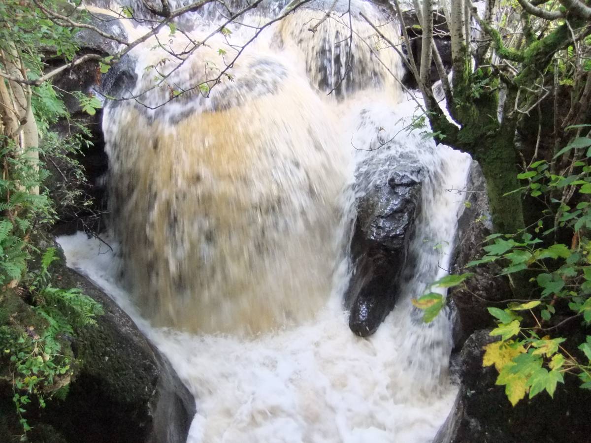
| Record Description | The access road to Appletree Thwaite House and Pastures crosses Cliff Beck by means of a ford located at the top of a rocky ravine through which Cliff Beck thunders when in spate. In time of spate Cliff Beck must be crossed by means of an ancient stone arched footbridge which is less than a metre in width and has no parapet or guard rail.
Since this footbridge is situated just 3m downstream of the Upper Falls it is possible when standing on the bridge across the ravine to enjoy a unique sensation of risk from the Falls when in flood. The Upper Falls are at same level as the bridge and very close indeed. |
| Image 1 ID | 3452 Click image to enlarge |
| Image 1 Description | Cliff Beck. Scar House Upper Falls in spate, photographed from the stone bridge.. | 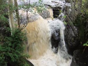 |
| Image 2 ID | 3453 Click image to enlarge |
| Image 2 Description | Cliff Beck. Scar House Upper Falls. |  |